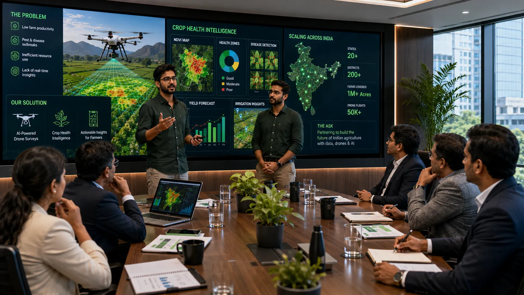
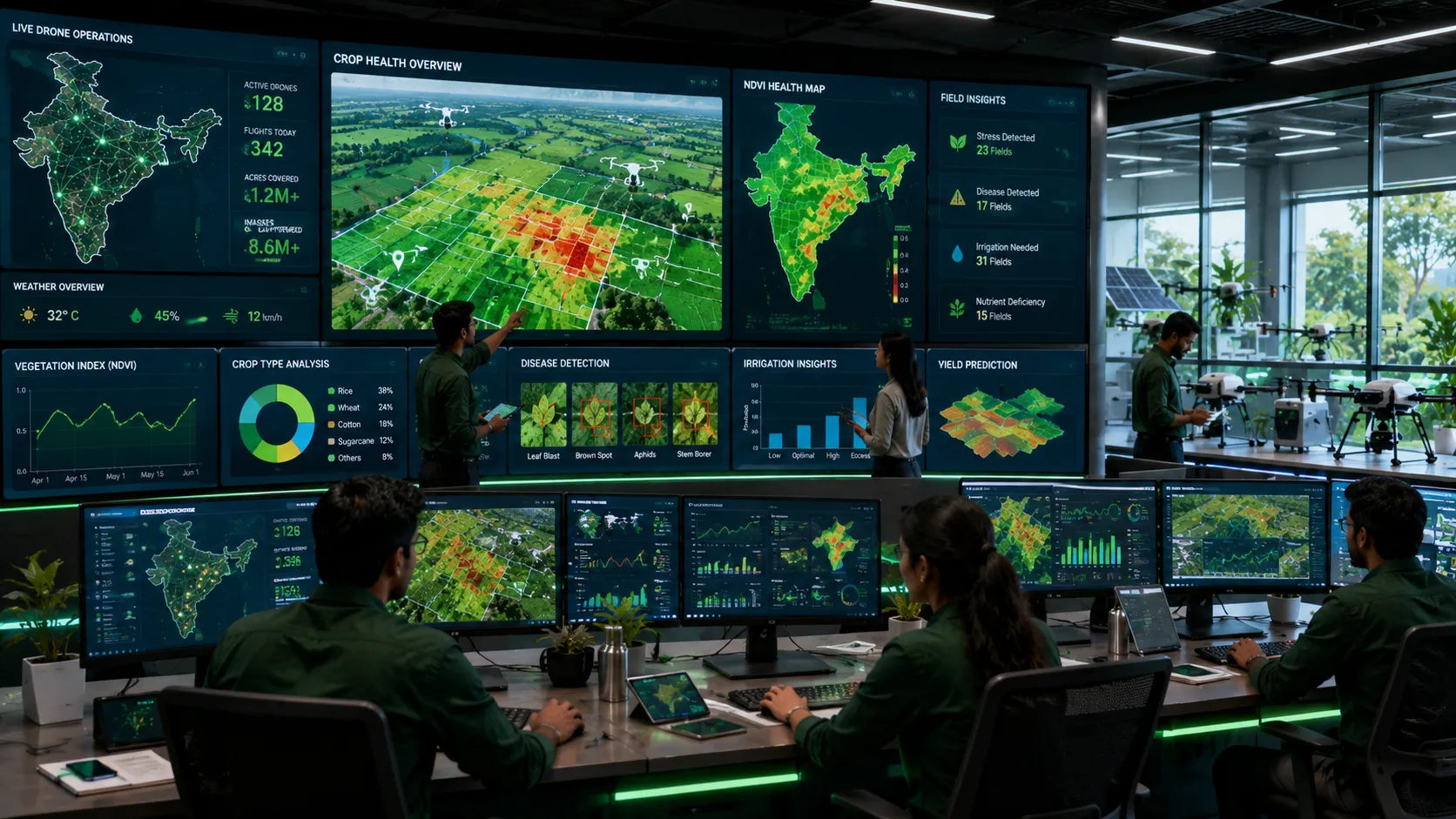
Most Indian farmers cannot afford a drone, nor do they have the skills to fly one. But they urgently need the information that drones provide: which parts of their field are nutrient‑deficient, infested with pests, or water‑stressed. Without this data, farmers apply fertilizers and pesticides uniformly – over‑treating some areas and under‑treating others, wasting money and harming the environment. FarmEye, a Gurugram‑based startup, has built a service that dispatches commercial drones to survey farms, processes the multispectral images, and delivers actionable reports to farmers via SMS and WhatsApp. The company has raised $12 million in Series A funding led by Omnivore Partners, with participation from Syngenta Ventures and RTP Global. The funds will be used to scale its drone fleet to 200 units and cover 1 million acres by 2027, reaching an estimated 200,000 smallholder farmers.
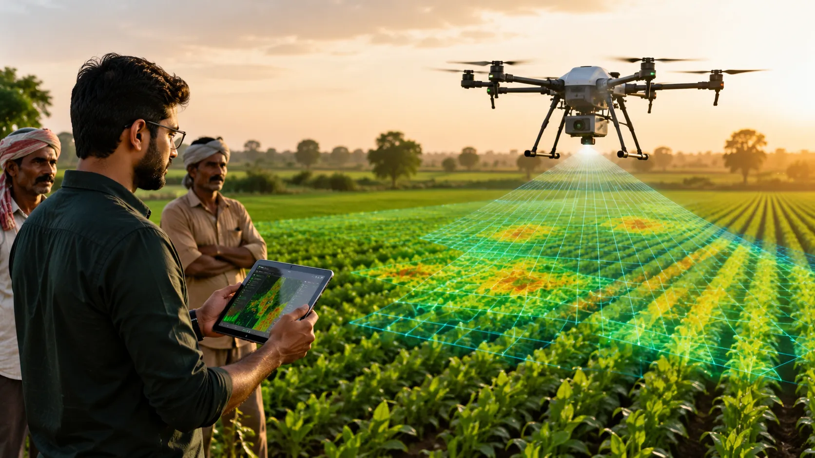
FarmEye works with farmer producer organizations (FPOs) and cooperatives. The FPO aggregates demand from 500‑1,000 farmers, and FarmEye sends a drone to capture images at 10‑cm resolution. The multispectral camera captures five bands: red, green, blue, near‑infrared, and red edge. From these, the software calculates vegetation indices like NDVI (Normalized Difference Vegetation Index) and NDRE, which correlate with plant health, chlorophyll content, and water stress. The data is analyzed using proprietary algorithms that identify nitrogen deficiency, red spider mite infestation, waterlogging, and early signs of fungal disease. Within 48 hours of the survey, each farmer receives a field‑zone‑specific report in their local language – for example, “Your northeast corner needs urea; the southwest corner has early blight; the center is healthy.” The service costs ₹300 ($3.60) per acre per season, which is subsidized by government schemes in Punjab, Haryana, and Maharashtra.
“Farmers typically apply fertilizer uniformly across the whole field, which leads to waste in good zones and deficiency in bad zones,” said co‑founder and CEO Vikram Singh, a former ISRO remote sensing scientist. “Our reports enable variable rate application, reducing input costs by 15‑20% and increasing yield by 10‑15%.” In a pilot across 50,000 acres in Punjab and Haryana, FarmEye’s recommendations helped farmers save ₹2,500 ($30) per acre on fertilizer and pesticide costs, while increasing wheat yield by 12% and rice yield by 9%. The savings more than paid for the service, making it economically attractive even without subsidies.
The Series A round comes as Indian agriculture faces pressure to become more sustainable while feeding a growing population. The government’s Digital Agriculture Mission 2026 has earmarked $100 million for precision farming technologies, including drone surveys. FarmEye is in talks with the state governments of Maharashtra, Karnataka, and Madhya Pradesh for large‑scale contracts covering 500,000 acres. The startup has also been empanelled by the Ministry of Agriculture as a “preferred service provider” for the National Mission on Sustainable Agriculture.
FarmEye will use the funds to build a network of drone pilots – many of them trained from rural areas. The company has established a training center in Haryana that has already certified 200 drone pilots under the government’s Drone Shakti scheme. Each pilot can cover up to 500 acres per day, earning a livelihood while serving local farmers. FarmEye is also developing a mobile app that allows farmers to request a survey on demand, without going through an FPO – a feature aimed at larger landholders. The company is experimenting with drone‑based spraying for spot treatment of pest outbreaks, which could further reduce pesticide use by 70% compared to blanket spraying.
Competitors include BharatRohan (which focuses on hyperspectral imaging) and Skylark Drones (which serves plantation crops). But FarmEye’s advantage is its focus on smallholder economics and its integration with government subsidy programs. While BharatRohan charges ₹500 per acre, FarmEye’s ₹300 per acre is more accessible. The startup also has a unique “pay‑after‑harvest” option: farmers can pay 50% of the fee after the survey and the remaining 50% after harvest, when they have cash flow. This model has increased adoption by 40% in pilot areas.
The technology stack includes a custom‑built drone that can fly for 40 minutes per battery, covering 100 acres per flight. The drone is ruggedized for dusty and windy field conditions, with replaceable parts. The image processing pipeline runs on a cloud server but can also operate offline in areas with poor connectivity, using edge computing on a local laptop. FarmEye has filed a patent for its “zone delineation algorithm,” which automatically divides a field into management zones based on historical and current data, allowing farmers to track year‑on‑year changes.
The social impact is significant. India’s smallholders (average farm size 1.1 hectares) are among the most inefficient users of inputs, partly because they lack information. A 2024 study by the Indian Council of Agricultural Research (ICAR) found that smallholders waste 30% of nitrogen fertilizer, costing the country $10 billion annually and contributing to greenhouse gas emissions and groundwater contamination. By providing precise recommendations, FarmEye can reduce that waste, improve farmer profitability, and reduce environmental damage. “Every rupee saved on fertilizer is a rupee of profit,” said Singh. “And every rupee of profit helps keep farmers on the land, reversing the trend of rural‑to‑urban migration.”
FarmEye’s long‑term vision is to create a “digital twin” of every farm in India – a virtual model that integrates soil data, weather forecasts, pest models, and crop genetics to predict yields and recommend interventions. The company is already piloting a yield prediction model that uses historical drone data and machine learning to forecast wheat yields within 5% accuracy, two months before harvest. This could help farmers negotiate better prices and help governments plan procurement and distribution.
For the 1.2 million farmers who will be covered by FarmEye’s surveys over the next two years, the immediate benefit is clear: lower costs, higher yields, and less guesswork. A farmer in Punjab who used FarmEye last season told us, “Earlier, I would put the same fertilizer everywhere. Now I know exactly where to put more and where to put less. My yield went up, and my bill went down. The drone is worth every rupee.” With fresh funding and a clear roadmap, FarmEye is poised to bring precision agriculture to the farmers who need it most.